Disaster Readiness Platform
Turn preparedness data into community action.
Civasure combines population survey data, FEMA risk indices, and actionable insights to help emergency planners build targeted readiness campaigns.
The reality
Emergency managers plan for disasters without knowing how ready their communities actually are.
FEMA maps hazard risk. CDC maps social vulnerability. But nobody maps population preparedness: whether people in flood-prone ZIPs have go-bags, whether elderly residents have evacuation plans, whether anyone knows where the nearest shelter is.
That data doesn't exist until after a disaster hits. Counties learn how ready people were based on how badly things went. Planning happens with good intentions and zero baseline, and there's no way to tell if outreach, trainings, or public campaigns actually changed anything.
Civasure closes that gap. Collect preparedness data before the disaster, combine it with federal risk indices, and give emergency managers an actual picture of where their communities stand, and the tools to do something about it.
Capabilities
The first pre-disaster intelligence platform
Collect population preparedness data, layer it with federal risk indices, identify gaps, and run campaigns to close them.
Anonymous Surveys
Collect population-level preparedness data through a mobile app that requires nothing from respondents. Completely anonymous, completely frictionless, and the data is yours to act on.
Multi-Source Intelligence
Layer survey responses with FEMA National Risk Index, CDC Social Vulnerability Index, and Census demographics. See a complete picture no single source can provide.
Gap Analysis
Identify preparedness gaps across your communities and surface targeted actions to close them.
Readiness Campaigns
Create scoped initiatives with geographic precision. Track progress and measure impact over time.
Push Notifications
Reach communities directly through the mobile app with timely preparedness information.
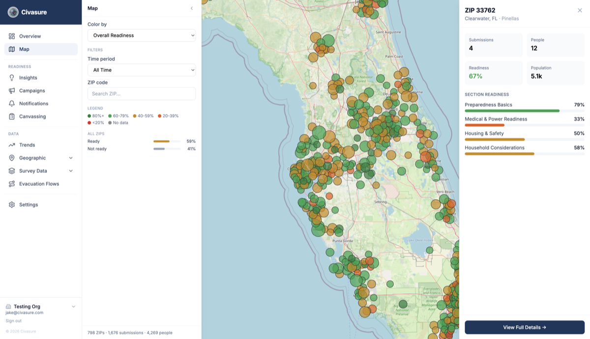
Geographic Scoping
Analysis at ZIP, county, and regional levels. See exactly where readiness gaps exist.
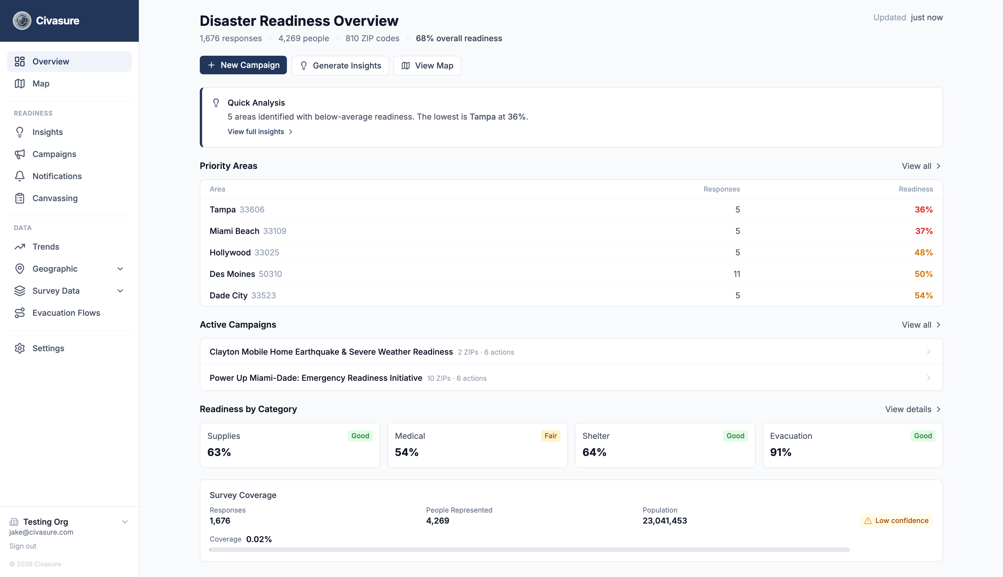
The Platform
See your community's readiness at a glance
Geographic intelligence, federal data overlays, and actionable insights at a glance.
Process
From blind spots to a feedback loop
Most counties plan for disasters without knowing how ready their population is. Civasure gives you the data and the tools to change that, and keep changing it.
Collect
Distribute anonymous preparedness surveys through the Civasure mobile app. Residents answer in a couple of minutes with nothing to sign up for, and you get a population-level baseline that hasn't existed until now.
2-min survey · No PII · ZIP-level attribution
Understand
Survey responses get layered with FEMA hazard risk, CDC social vulnerability, and Census demographics. See where gaps are and who is most at risk, down to the ZIP code.
FEMA NRI · CDC SVI · Census ACS · Survey data
Act
Launch targeted readiness campaigns scoped to specific geographies. Send push notifications to underserved ZIPs, coordinate canvassing in high-risk areas, distribute preparedness resources where they're actually needed.
Push notifications · Canvassing · QR outreach
Measure
Track whether readiness scores improve over time. See which campaigns drove real change and which fell flat. Each cycle informs the next.
Readiness trends · Campaign impact · Ongoing feedback
Then repeat. Every campaign generates new data, every survey sharpens the picture.
Trusted Foundation
Built on authoritative data and privacy by design
Anonymous by Design
The mobile app collects zero personally identifiable information. Survey responses are never tied to individuals, and privacy is a core product value, not a feature.
Built for Emergency Management
Built around the actual workflows of EMS coordinators, hospital groups, and county emergency managers.
Powered by Federal Data
Integrates FEMA National Risk Index, CDC Social Vulnerability Index, and Census American Community Survey data.
US ZIP codes covered
ZIP codes mapped
Federal data sources and growing
See what Civasure can do for your county.
Move from data to action with the first disaster readiness intelligence platform built for emergency management.